
OpenAir
Atlantic
Beta
ENFR soon
OpenAir
Atlantic
Stratford has parks, beaches, and trails that most visitors never find. OpenAir Atlantic monitors real-time conditions for every one of them — so you know exactly when to go, what to bring, and how long you have.

Jared Whyms
Founder, OpenAir Atlantic · · Charlottetown, Prince Edward Island

Stratford sits directly across the Hillsborough River from Charlottetown — 10 minutes by car, a short ferry ride in summer. It has a real trail network, a quiet red-sand beach, waterfront parks, and a growing outdoor community. Most visitors to PEI never cross the bridge. That means less crowd pressure on everything Stratford has — and the same weather data powering OpenAir Atlantic applies here just as much as it does in Cavendish or downtown Charlottetown.
This page explains what OpenAir Atlantic monitors for Stratford, what each data point means in practice, and which specific spots in the community each reading applies to. If you are planning a visit — or you live here and want to get more out of your outdoor time — the live dashboard is free and updated every 10 minutes.
OpenAir Atlantic pulls real-time data from Environment Canada weather stations and the Air Quality Health Index network. For Stratford, the nearest station is the Charlottetown airport — close enough that temperature, wind, and humidity readings are accurate to within a few minutes of current conditions. The tool displays six data points that directly affect outdoor decisions in this community:
Temperature & Feels Like
Updated every 10 minThe felt temperature accounts for wind and humidity — more useful than the air temperature alone for deciding whether to bring a layer on the trail.
UV Index
Burn time calculatedPEI UV regularly hits 7–9 in July. OpenAir calculates how long fair skin can be in direct sun before burning — shown per UV reading, not as a generic warning.
Air Quality (AQHI)
Health-based scale 1–10Stratford sits in a river valley. On hot, still days air quality can stratify. The AQHI reading tells you directly whether conditions are safe for children, seniors, and people with asthma.
Wind Speed & Direction
Live from EC stationsWind matters at Kinlock Beach, on the Hillsborough Bridge crossing, and on the exposed trail sections. Direction matters as much as speed — a southwest wind hits different spots than a northwest.
Precipitation Timing
3-hour window forecastNot just probability — the tool estimates when rain actually arrives. That difference between "40% chance of rain" and "rain arrives at 2:30pm" is the difference between a wasted trip and a good one.
Visibility
In kilometresVisibility above 12km means the cross-river view of Charlottetown from Stratford is at its best. Below 5km, fog has moved in from the Gulf — useful to know before a photography session.
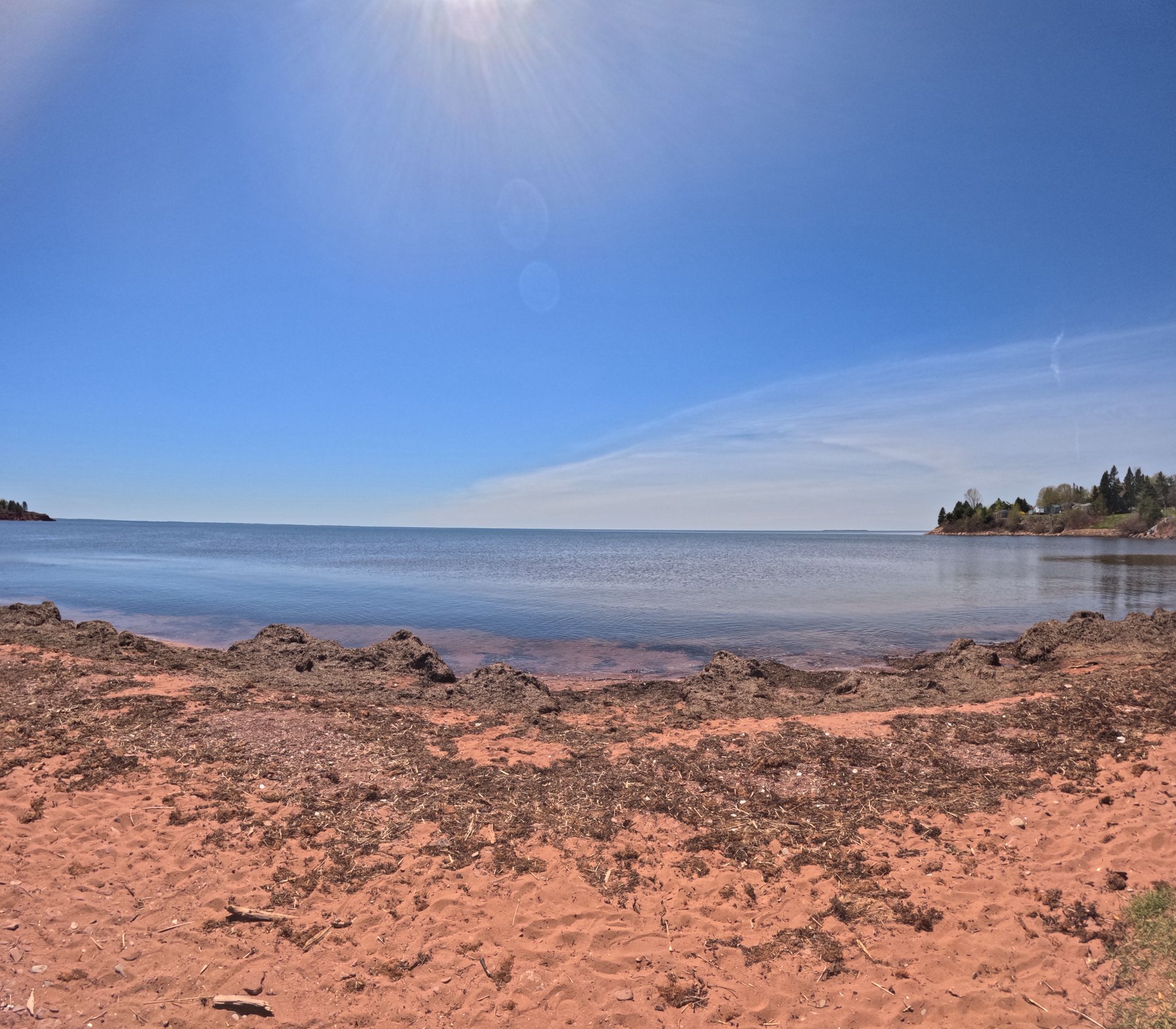
Kinlock Beach is a sheltered red-sand shoreline on the Stratford side of the Hillsborough River. Because it faces the river rather than the open Gulf, it reads differently from Cavendish or Basin Head — calmer water, warmer surface temperature in summer, and almost no wave action. It is excellent for children and paddlers.
The specific readings that matter most at Kinlock:

Stratford has invested in a paved multi-use trail corridor that runs roughly parallel to the Trans Canada Highway, connecting residential areas to the waterfront and linking into the broader Trans-Canada Trail network. Road bikes, hybrids, strollers, and inline skates all use it.
The trail is exposed in several sections — meaning wind, UV, and rain all hit harder here than in a wooded park. OpenAir Atlantic makes this visible:
Trail Conditions at a Glance

Pondside Park is Stratford's main waterfront greenspace — flat, accessible, open ground with water views and picnic areas. It connects directly to the trail network and is the easiest entry point for visitors arriving by car. On a good morning in July it is exactly what you want: river light, open sky, room to move.
The park is almost entirely open and east-facing — morning sun hits it fully, and by midday in summer the UV exposure is significant. The AQHI and UV readings on OpenAir Atlantic are the two most relevant data points here. Anything above UV 7 with children under 10 means shade is not optional. On AQHI days above 6, this is not a comfortable spot for people with respiratory conditions — the open river channel concentrates any pollution that has built up in the valley.
Why This Matters for Families
OpenAir Atlantic was built specifically to answer questions like “is it safe to bring my kids to the park right now?” The AQHI reading is translated into plain English — not a number on a scale, but a direct statement about who it is and is not safe for. Check it before the drive, not after you arrive.
Most weather apps give you a number. They do not tell you what it means for the specific thing you are trying to do — swim at Kinlock, cycle the trail, sit in Pondside Park with a toddler, or photograph the Charlottetown skyline from the Stratford shore at golden hour.
OpenAir Atlantic was built to close that gap. It takes the same Environment Canada data every other weather app uses — and interprets it. The UV index becomes a burn timer. The AQHI becomes a sentence about who should stay inside. The precipitation probability becomes an exact arrival time. Wind speed becomes a verdict on whether the bridge crossing is safe for cyclists.
Stratford benefits from this specifically because its outdoor spots are diverse enough that one reading does not apply everywhere. The wind that makes Kinlock Beach choppy does not affect the wooded Kinlock trail spur at all. The UV that makes Pondside Park uncomfortable at noon is irrelevant if you are walking under the tree canopy. The tool surfaces that distinction — so you can choose the right spot for the actual conditions, not just check if it is sunny.
“We built OpenAir Atlantic so that checking conditions before going outside takes 10 seconds and gives you a decision — not a forecast to interpret yourself.”
— Jared Whyms, Founder, OpenAir Atlantic
June through September is the reliable outdoor window for Stratford. July is peak — warmest temperatures, best swimming, most daylight. August is the local favourite: crowds thin mid-month, river water peaks at 22–24°C, and the evenings are long. September is underrated — UV drops, wind shifts northwest, and the light turns the particular gold-and-amber that PEI photographers wait for all year.
But the season is only part of the picture. A good July week can have three bad outdoor days in it. A grey September can have four perfect ones. The reason to use OpenAir Atlantic is precisely this: instead of planning around the calendar, you plan around the actual conditions on the actual day. The tool gives you a score — Excellent, Good, Fair, or Stay Inside — for every location, every 10 minutes. You look at it the night before, the morning of, and again an hour before you leave. That is the whole workflow.
Stratford Conditions by Season
Check live conditions for Stratford right now — free, no account required.
OpenAir Atlantic shows real-time temperature, UV, air quality, wind, and precipitation timing for Stratford and surrounding areas. Updated every 10 minutes from Environment Canada data. Built for Atlantic Canadians.
See live conditions →About OpenAir Atlantic
OpenAir Atlantic is a free public-good web service providing real-time outdoor conditions for communities across Atlantic Canada. Data is sourced from Environment Canada, Fisheries and Oceans Canada, and Open-Meteo. No advertising. No personal data collected. openairatlantic.com